WONDERS OF THE WORLD
THE TAJ MAHAL

The Taj Mahal India was first described as "a drop of tear on the cheek of history" by India's Poet laureate, Rabindranath Tagore, who was Asia’s first Nobel Prize winner.
The Taj Mahal India encompasses a tragic and enduring love story in the perfect symmetrical dream in marble that is one of the Seven Wonders of the World.
The Taj Mahal India was created by Shah Jahan, the fifth Mughal Emperor as a monument to his love for his second wife, Mumtaz Mahal. Her final resting place is located in the city of Agra, in the northern Indian state of Uttar Pradesh, on the banks of the Yamuna River.
History of the Taj Mahal India
History of the Taj Mahal India shows that construction began in 1631 and took 22 years to complete with a work force of more than 20,000 men. It was finally finished in 1653 at a cost of 32 million Rupee or $400 million in today’s prices.
Nor surprisingly there have been many claims and counter claims regarding the Taj Mahal history and those who were responsible for its design and constrution.
Taj Mahal history does record that it was not designed by a single person. The project demanded the varied talents, creativity, artistry, skills and abilities of many. Twenty thousand workmen and master craftsmen- from Persia, France, Iran, Italy and Turkey worked on the building and their names were recorded for posterity on scrolls.
Fact of the Taj Mahal – Construction Feats
Facts of the Taj Mahal and its construction commence with the way the land was acquired for its construction to the south of the walled city of Agra. The site chosen by Shah Jahan for the resting place of his beloved wife had belonged to Maharajah Jai Singh. Shah Jahan presented him with a large palace in the centre of Agra in exchange for the site for his Taj Mahal.
An area of roughly three acres for the foundations was excavated and filled with dirt to reduce seepage from the river. The entire site was levelled to a fixed height about 50 m above the riverbank. The Taj Mahal is 180 feet tall. The dome itself measures 60 feet in diameter and 80 feet high.
In the tomb area, wells were then dug down until water was encountered. These wells were later filled with stone and rubble, forming the basis for the footings of the tomb. An additional well was built to same depth nearby to provide a visual method to track water level changes over time.
Instead of lashed bamboo, the typical scaffolding method, workmen constructed a colossal brick scaffold that mirrored the inner and outer surfaces of the tomb. The scaffold was so enormous that foremen estimated it would take years to dismantle.
According to legend, Shah Jahan decreed that anyone could keep bricks taken from the scaffold, and it was dismantled by peasants overnight.
The Taj Mahal construction facts reveal that a 15-kilometre tamped-earth ramp was built to transport marble and materials from Agra to the construction site. According to contemporary accounts teams of twenty or thirty oxen strained to pull the blocks on specially constructed wagons.
To raise the blocks into position required an elaborate post-and-beam pulley system. Teams of mules and oxen provided the lifting power. The order of construction was:
The plinth. The tomb. The four minarets. The mosque and jawab. The gateway.
The plinth and tomb took roughly 12 years to complete. The remaining parts of the complex took an additional 10 years. (Since the complex was built in stages, contemporary historical accounts list different "completion dates"; discrepancies between so-called completion dates are probably the result of differing opinions about the definition of "completion". For example, the mausoleum itself was essentially complete by 1643, but work continued on the rest of the complex.
GEOGRAPHICAL WORLD
.jpg)
TRAVEL THE WHOLE WORLD WITH GEOMAPIA
RICHMOND, VIRGINIA
GETTYSBURG, PENNSYLVANIA
FLAGSTAFF, ARIZONA
DENVER, COLORADO
CHICAGO, ILLINOIS
CHATTANOOGA, TENNESSEE
CHARLOTTE, NORTH CAROLINA
CHARLESTON, SOUTH CAROLINA
Puuhonua O Honaunau
Stonehenge
Death Valley
Mohave or Mojave desert
Bryce Canyon
Grand Canyon National Park
Mausoleum of Maussollos
The word mausoleum has since come to be used generically for any grand tomb, though "Mausol – eion" originally meant "[building] dedicated to Mausolus". Another opinion is that the etymology for this word can be found in the germanic Language. "Mohsa" (mauso) meaning marsh and "Lehm" (leum) meaning lime.
Statue of Zeus at Olympia
The date of the statue, in the third quarter of the fifth century BC, long a subject of debate, was confirmed archaeologically by the rediscovery and excavation of Phidias' workshop.
MAPS & FLAGS OF COUNTRIES ALL AROUND THE WORLD
MAP AND FLAG OF VIETNAM
MAP AND FLAG OF VENEZUELA
MAP AND FLAG OF UZBEKISTAN
MAP AND FLAG OF USA
MAP AND FLAG OF URUGUAY
MAP AND FLAG OF UNITED KINGDOM
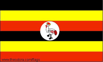
MAP AND FLAG OF UGANDA
MAP AND FLAG OF UAE
MAP AND FLAG OF TURKEY
MAP AND FLAG OF TUNISIA
MAP AND FLAG OF THAILAND
MAP AND FLAG OF TANZANIA
MAP AND FLAG OF TAIWAN
MAP AND FLAG OF NEW ZEALAND
MAP AND FLAG OF SWEDEN
MAP AND FLAG OF SWAZI LAND
MAP AND FLAG OF SUDAN
MAP AND FLAG OF SRI LANKA
MAP AND FLAG OF SPAIN
MAP AND FLAG OF SOUTH KOREA
MAP AND FLAG OF SOUTH AFRICA
MAP AND FLAG OF SOMALIA
MAP AND FLAG OF SINGAPORE
MAP AND FLAG OF SENEGAL
MAP AND FLAG OF SAUDI ARABIA
MAP AND FLAG OF RUSSIA
MAP AND FLAG OF ROMANIA
MAP AND FLAG OF QATAR
MAP AND FLAG OF PORTUGAL
MAP AND FLAG OF POLAND
MAP AND FLAG OF PHILIPPINES
MAP AND FLAG OF PERU
MAP AND FLAG OF PARAGUAY
FLAF OF PANAMA
MAP AND FLAG OF PALESTINE
MAP AND FLAG OF PAKISTAN
MAP AND FLAG OF OMAN
MAP AND FLAG OF NORWAY
MAP AND FLAG OF NORTH KOREA
MAP AND FLAG OF NIGERIA
MAP AND FLAG OF NEW ZEALAND
MAP AND FLAG OF NEPAL
MAP AND FLAG OF NAMIBIA
MAP AND FLAG OF MOZAMBIQUE
MAP AND FLAG OF MOROCCO
MAP AND FLAG OF MEXICO
MAP AND FLAG OF MAURITIUS
FLAF OF MANGOLIA MAP AND
MAP AND FLAG OF MALTA
MAP AND FLAG OF MALI
MAP AND FLAG OF MALDIVES
MAP AND FLAG OF MALAYSIA
MAP AND FLAG OF MALAWI
MAP AND FLAG OF LEBNAN
MAP AND FLAG OF KYRGYZSTAN
MAP AND FLAG OF KENYA
MAP AND FLAG OF JORDAN
MAP AND FLAG OF JAPAN
MAP AND FLAG OF JAMAICA
FLAF OF IVORY COST
MAP AND FLAG OF ITALY
MAP AND FLAG OF ISRAEL
MAP AND FLAG OF IRELAND
MAP AND FLAG OF IRAQ
MAP AND FLAG OF IRAN
MAP AND FLAG OF INDONESIA
MAP AND FLAG OF INDIA
MAP AND FLAG OF ICELAND
MAP AND FLAG OF HUNGRY
MAP AND FLAG OF HONG KONG
MAP AND FLAG OF HOLLAND
MAP AND FLAG OF GHAYANA
MAP OF GREECE FLAG OF GREECE
FLAG OF GHANA MAP OF GHANA
MAP OF GERMANY
FLAF OF GERMANY
FLAG OF GEORGIA
MAP OF GEORGIA
MAP OF FRANCE
FLAG OF FRANCE
MAP OF FINLAND
FLAG OF FINLAND
MAP OF FIJI
FLAG OF FIJI MAP OF ETHIOPIA
FLAG OF ETHIOPIA
MAP OF EGYPT
FLAG OF EGYPT
FLAG OF DENMARK
MAP OF DENMARK
MAP OF CZECH REPUBLIC
FLAG OF CZECH REPUBLIC
MAP OF CYPRUS FLAG OF CYPRUS
MAP OF CUBA
FLAG OF CUBA
MAP OF CONGO
FLAG OF CONGO
MAP OF COLOMBIA
FLAG OF COLOMBIA
FLAG OF CHILE
MAP OF CHILE
MAP OF CENTRAL AFRICAN REPUBLIC
FLAG OF CENTRAL AFRICAN REPUBLIC
FLAG OF CANADA
MAP OF CANADA
FLAF OF CAMERON MAP OF CAMERON
MAP OF CAMBODIA
FLAG OF CAMBODIA
MAP OF BURMA
FLAG OF BURMA
MAP OF BRUNEI
MAP OF BRAZIL
FLAG OF BRAZIL
MAP OF BOLIVIA
FLAG OF BOLIVIA
FLAG OF BHUTAN
MAP OF BHUTAN
FLAG OF BELGIUM
MAP OF BELGIUM
FLAG OF BEHRAIN
MAP OF BEHRAIN MAP OF BANGLADESH
FLAG OF BANGLADESH
FLAG OF AZERBAIJAN MAP OF AZERBAIJAN
MAP OF AUSTRIA
FLAG OF AUSTRIA
MAP OF AUSTRALIA
MAP OF ARMENIA
FLAG OF ARMENIA
MAP OF ARGENTINA
MAP OF ARGENTINA
FLAG OF ANGULIA
MAP OF ANGULIA
FLAG OF ALGERIA
MAP OF ALGERIA
FLAG OF ALBANIA
MAP OF AFGHANISTAN
FLAG OF AFGHANISTAN
Lighthouse of Alexandria
With a height variously estimated at between 115 and 135 m (380 and 440 ft) it was identified as one of the Seven Wonders of the Ancient World by Antipater of Sidon. It may have been the third tallest building after the two Great Pyramids (of Khufu and Khafra) for its entire life.Pharos was a small island just off the coast of Alexandria. It was linked to the mainland by a man-made connection named the Heptastadion, which thus formed one side of the city's harbor. As the Egyptian coast is very flat and lacking in the kind of landmark used at the time for navigation, a marker of some sort at the mouth of the harbour was deemed necessary—a function the Pharos was initially designed to serve. Use of the building as a lighthouse, with a fire and reflective mirrors at the top, is thought to date to around the 1st century AD, during the Roman period. Prior to that time the Pharos served solely as a landmark or day beacon
The lighthouse was completed in the 3rd century B.C., after having been initiated by Satrap (governor) Ptolemy I Soter, Egypt's first Macedonian ruler and a general of Alexander the Great. After Alexander died unexpectedly at age 32, Ptolemy Soter (Saviour, named so by the inhabitants of Rhodes) made himself king in 305 B.C. and ordered the construction of the Pharos shortly thereafter. The building was finished during the reign of his son, Ptolemy Philadelphos.
Colossus of Rhodes
This article is about the statue. For the children's novel by Caroline Lawrence, see The Colossus of Rhodes (novel).
This drawing of Colossus of Rhodes, which illustrated The Grolier Society's 1911 Book of Knowledge, is probably fanciful, as the statue likely did not stand astride the harbour mouth.
Colossus of Rhodes, imagined in a 16th-century engraving by Martin Heemskerck, part of his series of the Seven Wonders of the World.
The Colossus of Rhodes was a statue of the Greek god Helios, erected on the Greek island of Rhodes by Chares of Lindos between 292 and 280 BC. It is considered one of the Seven Wonders of the Ancient World. Before its destruction, the Colossus of Rhodes stood over 30 meters (107 ft) high, making it one of the tallest statues of the ancient world.[
Temple of Artemis
The new temple antedated the Ionic immigration by many years. Callimachus, in his Hymn to Artemis, attributed the origin of the temenos at Ephesus to the Amazons, whose worship he imagines already centered upon an image (bretas). In the seventh century the old temple was destroyed by a flood. Around 550 BC, they started to build the "new" temple, known as one of the wonders of the ancient world. It was a 120-year project, initially designed and constructed by the Cretan architect Chersiphron and his son Metagenes, at the expense of Croesus of Lydia.


